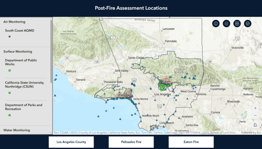
The Los Angeles County Department of Public Health launched an interactive online dashboard that provides access to environmental and personal health surveillance to the public in the wake of a wildfire in January.
Provides a visual overview of LA County-wide monitoring locations, the dashboard, which is part of Los Angeles County’s Aviation, Soil Assessment Plan, was developed in collaboration with local and state partners, LACDPH said in a media release issued Wednesday.
More Southern California student visas have been revoked this time in Orange County
The technology provides users with a visual overview of the monitoring location, including where the assessment is being done to measure four key metrics.
Air: Indoor and outdoor air quality assessment to detect contaminants that may affect respiratory hygiene surfaces: Testing contaminants on indoor surfaces, soil, coastal sand, wildfire debris determines water to determine exposure risk.
“This dashboard is part of Los Angeles County’s commitment to transparency, public engagement and community well-being,” an official with LACDPH said in a media release Wednesday. “By making this information accessible, the department aims to empower residents with timely, science-based insights into the potential environmental health impacts of recent wildfires.”
The Los Angeles County Department of Public Health launched an interactive online dashboard that provides access to environmental and personal health surveillance to the public in the wake of a wildfire in January. (lacdph)
Data collected and shared via the dashboard will continue to inform you of long-term recovery efforts and guide health recommendations. However, authorities noted that the technology currently lacks data from all locations, including paths from mobile surveillance units.
That information will be added to the new dashboard when it becomes available, Public Health said.
Source link


