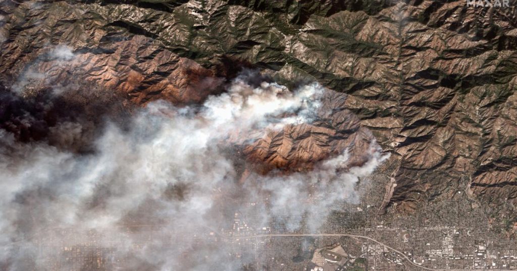
The Palisades and Eaton fires have displaced tens of thousands of residents, leaving them wondering what will remain of their homes in Pacific Palisades, Altadena, and surrounding areas.
New satellite images reveal for the first time some of the most affected areas.
The image below shows Malibu’s famous residential area wedged between the Pacific Coast Highway and the ocean just west of Topanga Beach.
Most structures in the area near Tuna Canyon Road were gone by Wednesday, according to infrared satellite images provided by Maxar Technologies.
The Palisades Fire broke out Tuesday and had burned more than 1,000 homes, businesses and other buildings by Wednesday afternoon, but few homes in this area of PCH were saved.
About 80 miles away in Altadena, the Eaton Fire had killed five people and burned dozens of homes as of Wednesday afternoon.
The images below show homes and businesses on East Altadena Drive before and during the fire.
Satellite infrared images showed dozens of structures ablaze on Wednesday, with many more completely destroyed.
The Eaton Fire, which broke out Tuesday night, had burned about 10,600 homes in Altadena and Pasadena as of Wednesday afternoon.
The area pictured above was still burning heavily on Wednesday, but further to the northwest, fires had already caused severe damage, leaving most homes in smoldering ruins.
The above satellite image taken on Marathon Road in Altadena on Wednesday showed homes almost completely destroyed.
With fire resources gone, the residents of Altadena found themselves fighting the flames.
Source link


